Suche einschränken:
Zur Kasse

6 Ergebnisse.

Lewis and Clark Trail Maps: Columbia River to the Pacific...

Plamondon II, Martin
Lewis and Clark Trail Maps: Columbia River to the Pacific Ocean, and Further Columbia, Marias, and Yellowstone Explorations (Washington/Oregon/Ida
After crossing the Bitterroot Range and canoeing down the cataract-filled Snake River, the Corps of Discovery finally reached the long-sought Columbia River in the autumn of 1805. Volume III continues the cartographic reconstruction of the explorers' trek as they set out from the Snake-Columbia junction, October 18, 1805, on the final leg of their journey to the sea. In addition to intricately mapping the Columbia's great rapids, desert and ra...

CHF 40.90

Lewis and Clark Trail Maps: A Cartographic Reconstruction...

Plamondon II, Martin
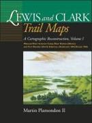
Lewis and Clark Trail Maps: A Cartographic Reconstruction, Volume I: Missouri River Between Camp River DuBois (Illinois) and Fort Mandan (North Da
By using measurements and notes in William Clark's journals, Plamondon has created maps depicting the Corps of Discovery's route on the Missouri River from Illinois to North Dakota in 1804. The maps compare the modern beds of streams to their courses at the time of exploration. Of further interest are excerpts from the expedition diaries and an insightful essay on frontier surveying.

CHF 41.90

Lewis and Clark Trail Maps: A Cartographic Reconstruction...

Plamondon II, Martin
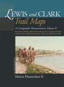
Lewis and Clark Trail Maps: A Cartographic Reconstruction, Volume II: Beyond Fort Mandan (North Dakota/Montana) to Continental Divide and Snake Ri
Beginning a short distance above Fort Mandan, 180 maps depict the explorers' route in 1805-6 on the Missouri River in North Dakota and Montana, over the continental divide to Idaho, and on westward-flowing waters to the Snake-Columbia confluence in central Washington. As in Volume I, the maps contrast modern riverbeds to their courses at the time of exploration.

CHF 41.90

Lewis and Clark Trail Maps: A Cartographic Reconstruction...

Plamondon II, Martin
Lewis and Clark Trail Maps: A Cartographic Reconstruction, Volume I: Missouri River Between Camp River DuBois (Illinois) and Fort Mandan (North Da
By using measurements and notes in William Clark's journals, Plamondon has created maps depicting the Corps of Discovery's route on the Missouri River from Illinois to North Dakota in 1804. The maps compare the modern beds of streams to their courses at the time of exploration. Of further interest are excerpts from the expedition diaries and an insightful essay on frontier surveying.

CHF 40.90