Suche einschränken:
Zur Kasse

2 Ergebnisse.

Remote Sensing for Geoscientists

Prost, Gary L
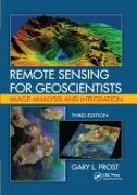
Remote Sensing for Geoscientists
This book is an updated and expanded version of the existing text that explains what remote sensing is and how to use it in the earth sciences. It serves as a how-to guide and reference for those requiring remote sensing to assist with geologic mapping, landform analysis, petroleum and mineral exploration, groundwater development, civil engineer

CHF 131.00

Remote Sensing for Geoscientists

Prost, Gary L.
Remote Sensing for Geoscientists
This third edition of the bestselling Remote Sensing for Geologists: A Guide to Image Interpretation is now titled Remote Sensing for Geoscientists: Image Analysis and Integration. The title change reflects that this edition applies to a broad spectrum of geosciences, not just geology, stresses that remote sensing has become more than photointerpretation, and emphasizes integration of multiple remote sensing technologies to solve Earth science...

CHF 226.00