Suche einschränken:
Zur Kasse

1286 Ergebnisse - Zeige 1261 von 1280.

Delmarva Peninsula Map

National Geographic Maps
Delmarva Peninsula Map
National Geographic's Trails Illustrated Maps are the most detailed and up-to-date topographic recreation maps available for US National Parks, National Forests and other popular outdoor recreation areas. A necessity for exploring the outdoors, each map is printed on waterproof, tear-resistant material. They also contain key safety and contact information, GPS and compass coordinates, Leave No Trace ethical guidelines and hundreds of points-of...

CHF 22.90

Carlsbad Caverns National Park Map

National Geographic Maps
Carlsbad Caverns National Park Map
National Geographic's Trails Illustrated Maps are the most detailed and up-to-date topographic recreation maps available for US National Parks, National Forests and other popular outdoor recreation areas. A necessity for exploring the outdoors, each map is printed on waterproof, tear-resistant material. They also contain key safety and contact information, GPS and compass coordinates, Leave No Trace ethical guidelines and hundreds of points-of...

CHF 22.90

Hoosier National Forest Map

National Geographic Maps
Hoosier National Forest Map
Coverage includes Patoka Lake State Reservoir, Harrison Crawford State Forest, Ohio River, Yellowbank State Wildlife Management Area, Brown County State Park, Martin State Forest, insets of Two Lakes and German Ridge. Towns include Tell City, Bloomington, Mitchell, Paoli, Orleans, French Lick. Includes UTM grids for use with your GPS unit.

CHF 22.90

Apostle Islands National Lakeshore Map

National Geographic Maps
Apostle Islands National Lakeshore Map
National Geographic's Trails Illustrated Maps are the most detailed and up-to-date topographic recreation maps available for US National Parks, National Forests and other popular outdoor recreation areas. A necessity for exploring the outdoors, each map is printed on waterproof, tear-resistant material. They also contain key safety and contact information, GPS and compass coordinates, Leave No Trace ethical guidelines and hundreds of points-of...

CHF 22.90

Indian Peaks, Gold Hill Map

National Geographic Maps
Indian Peaks, Gold Hill Map
Coverage includes Roosevelt and Arapaho national forests, Indian Peaks Wilderness, Arapaho National Recreation Area, Tabernash, Fraser, Nederland, Eldora, Ward, Peaceful Valley, Lake Granby, Barker and Beaver reservoirs, Pawnee, Arapaho and Rollins passes. Devils Thumb cross-country ski area. Includes UTM grids for use with your GPS unit.

CHF 22.90

Tahoe National Forest East Map [Sierra Buttes, Donner Pass]

National Geographic Maps
Tahoe National Forest East Map [Sierra Buttes, Donner Pass]
National Geographic's Trails Illustrated Maps are the most detailed and up-to-date topographic recreation maps available for US National Parks, National Forests and other popular outdoor recreation areas. A necessity for exploring the outdoors, each map is printed on waterproof, tear-resistant material. They also contain key safety and contact information, GPS and compass coordinates, Leave No Trace ethical guidelines and hundreds of points-of...

CHF 22.90

Moab South

National Geographic Maps - Trails Illust
Moab South
National Geographic's Trails Illustrated Maps are the most detailed and up-to-date topographic recreation maps available for US National Parks, National Forests and other popular outdoor recreation areas. A necessity for exploring the outdoors, each map is printed on waterproof, tear-resistant material. They also contain key safety and contact information, GPS and compass coordinates, Leave No Trace ethical guidelines and hundreds of points-of...

CHF 23.50

Mount Rogers National Recreation Area Map [Jefferson Nati...

National Geographic Maps
Mount Rogers National Recreation Area Map [Jefferson National Forest]
National Geographic's Trails Illustrated Maps are the most detailed and up-to-date topographic recreation maps available for US National Parks, National Forests and other popular outdoor recreation areas. A necessity for exploring the outdoors, each map is printed on waterproof, tear-resistant material. They also contain key safety and contact information, GPS and compass coordinates, Leave No Trace ethical guidelines and hundreds of points-of...

CHF 22.90

Cedar City, Markagunt Plateau Map

National Geographic Maps
Cedar City, Markagunt Plateau Map
Coverage includes Dixie National Forest, Ashdown Gorge Wilderness, Cedar Breaks National Monument, Brian Head, Navajo Lake, Haycock Mountain, Panguitch Lake, Long Valley Junction and Duck Creek. Includes UTM grids for use with your GPS unit.

CHF 22.90

Joshua Tree National Park Map

National Geographic Maps
Joshua Tree National Park Map
National Geographic's Trails Illustrated Maps are the most detailed and up-to-date topographic recreation maps available for US National Parks, National Forests and other popular outdoor recreation areas. A necessity for exploring the outdoors, each map is printed on waterproof, tear-resistant material. They also contain key safety and contact information, GPS and compass coordinates, Leave No Trace ethical guidelines and hundreds of points-of...

CHF 22.90

Merced and Tuolumne Rivers Map [Stanislaus National Forest]

National Geographic Maps
Merced and Tuolumne Rivers Map [Stanislaus National Forest]
National Geographic's Trails Illustrated Maps are the most detailed and up-to-date topographic recreation maps available for US National Parks, National Forests and other popular outdoor recreation areas. A necessity for exploring the outdoors, each map is printed on waterproof, tear-resistant material. They also contain key safety and contact information, GPS and compass coordinates, Leave No Trace ethical guidelines and hundreds of points-of...

CHF 22.90

Santa Monica Mountains National Recreation Area Map

National Geographic Maps
Santa Monica Mountains National Recreation Area Map
National Geographic's Trails Illustrated Maps are the most detailed and up-to-date topographic recreation maps available for US National Parks, National Forests and other popular outdoor recreation areas. A necessity for exploring the outdoors, each map is printed on waterproof, tear-resistant material. They also contain key safety and contact information, GPS and compass coordinates, Leave No Trace ethical guidelines and hundreds of points-of...

CHF 22.90

Isle Royale National Park Map

National Geographic Maps
Isle Royale National Park Map
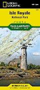
This Trails Illustrated topographic map for Isle Royale National Park, north of the Upper Peninsula of Michigan in Lake Superior, is the perfect map for hiking, paddling, boating, biking, exploring, climbing, camping, and sightseeing in this beautiful area. The map includes Isle Royale, Washington Island, Grace Island, Johns Island, Thompson Island, Amygdaloid Island, Belle Island, Passage Island, Windigo, Minong Ridge, Greenstone Ridge, Feldt...

CHF 22.90

Pisgah Ranger District, Pisgah National Forest, North Car...

National Geographic Maps
Pisgah Ranger District, Pisgah National Forest, North Carolina, USA Outdoor Recreation Map
Coverage includes Pisgah National Forest, Shining Rock and Middle Prong wilderness areas, Bent Creek Research and Demonstration Forest, North Carolina Arboretum, Blue Ridge Parkway, Mountains-to-Sea Trail, Looking Glass Rock, Cold Mountain, Sliding Rock and Mount Pisgah recreation areas, Looking Glass Falls, and Cradle of Forestry in America National Historic Site. Towns: Asheville, Waynesville, Brevard. Includes UTM grids for use with your GP...

CHF 22.90