Suche einschränken:
Zur Kasse

1554 Ergebnisse - Zeige 1 von 20.

Top 50 Romantic Hits

Top 50 Romantic Hits
Fifty of the most popular romantic hits ever written are now at your fingertips! This wide-ranging collection spans the worlds of movies, pop, Broadway and jazz. Each intermediate-level arrangement includes lyrics and chord symbols. Titles: A Certain Smile * Amazed * Angel Eyes * As Time Goes By * At Last * Beautiful (As You) * Beauty and the Beast * Because You Loved Me * Can You Feel the Love Tonight * Can You Read My Mind? * Come Rain or Co...

Speed, Power, Control, Endurance

Chapin, Jim
Speed, Power, Control, Endurance
Many of the world's great drummers credit their skills in part to Jim's teaching and his books, Advanced Techniques for the Modern Drummer, Volumes 1 and 2. Whether a beginner or an accomplished drummer, this DVD (with added master-class footage) will continue to help drummers of all styles and levels achieve more Speed, Power, Control and Endurance. Enjoy the Chapin magic!

Death Valley National Park Map

National Geographic Maps
Death Valley National Park Map
This Trails Illustrated topographic map for Death Valley National Park, which straddles the state lines of eastern California and western Nevada, is the perfect recreational map for this dramatic park, which encompasses the hottest, driest, and lowest places in the US. Within its three million acres you will find oceans of sand dunes, dramatic snow-capped mountains, spectacular geological formations, and breathtaking views. The map includes th...

Especially in Romantic Style, Book 2

Alexander, Dennis
Especially in Romantic Style, Book 2
This series was written for pianists who love the expressive qualities of the piano and the sounds of the romantic style. Warm, lyrical melodies and rich harmonies will inspire pianists to create a beautiful sound and to play with expression, musicality and finesse. The descriptive titles will spark students' imaginations as well. Titles: Arioso in D Major * Boston Blues * Enchanted Moments * Forest Whispers * Impromptu in G Minor * Jazz Roman...

Especially in Romantic Style, Book 3

Alexander, Dennis
Especially in Romantic Style, Book 3
This series was written for pianists who love the expressive qualities of the piano and the sounds of the romantic style. Warm, lyrical melodies and rich harmonies will inspire pianists to create a beautiful sound and to play with expression, musicality and finesse. The descriptive titles will spark students' imaginations as well. Titles: Evocation * Improvisation No. 1 * In a Dancin' Mood * Midnight Meditation * The Promise of Spring * Sereni...

Especially in Romantic Style, Book 1

Alexander, Dennis
Especially in Romantic Style, Book 1
This series was written for pianists who love the expressive qualities of the piano and the sounds of the romantic style. Warm, lyrical melodies and rich harmonies will inspire pianists to create a beautiful sound and to play with expression, musicality and finesse. The descriptive titles will spark students' imaginations as well. Titles: Autumn Mood * Footprints in the Sand * Forgotten Postcards * Gentle Breezes * La Serenata * Lost Romance B...

Big Bend National Park Map

National Geographic Maps
Big Bend National Park Map
The map includes Big Bend National Park, Portions of Big Bend Ranch State Park, Black Gap Wildlife Management ARea, the Chisos Mountains, Sierra del Carmen, Sierra del Caballo Muerto, designated backcountry camping sites, park information, and more. Includes UTM tick marks for use with your GPS unit.

Pisgah Ranger District, Pisgah National Forest, North Car...

National Geographic Maps
Pisgah Ranger District, Pisgah National Forest, North Carolina, USA Outdoor Recreation Map
Coverage includes Pisgah National Forest, Shining Rock and Middle Prong wilderness areas, Bent Creek Research and Demonstration Forest, North Carolina Arboretum, Blue Ridge Parkway, Mountains-to-Sea Trail, Looking Glass Rock, Cold Mountain, Sliding Rock and Mount Pisgah recreation areas, Looking Glass Falls, and Cradle of Forestry in America National Historic Site. Towns: Asheville, Waynesville, Brevard. Includes UTM grids for use with your GP...

Sangre de Cristo Mountains Map [Great Sand Dunes National...

National Geographic Maps
Sangre de Cristo Mountains Map [Great Sand Dunes National Park and Preserve]
National Geographic's Trails Illustrated Maps are the most detailed and up-to-date topographic recreation maps available for US National Parks, National Forests and other popular outdoor recreation areas. A necessity for exploring the outdoors, each map is printed on waterproof, tear-resistant material. They also contain key safety and contact information, GPS and compass coordinates, Leave No Trace ethical guidelines and hundreds of points-of...

Santa Monica Mountains National Recreation Area Map

National Geographic Maps
Santa Monica Mountains National Recreation Area Map
National Geographic's Trails Illustrated Maps are the most detailed and up-to-date topographic recreation maps available for US National Parks, National Forests and other popular outdoor recreation areas. A necessity for exploring the outdoors, each map is printed on waterproof, tear-resistant material. They also contain key safety and contact information, GPS and compass coordinates, Leave No Trace ethical guidelines and hundreds of points-of...

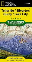
Telluride, Silverton, Ouray, Lake City Map

National Geographic Maps
Telluride, Silverton, Ouray, Lake City Map
National Geographic's Trails Illustrated Maps are the most detailed and up-to-date topographic recreation maps available for US National Parks, National Forests and other popular outdoor recreation areas. A necessity for exploring the outdoors, each map is printed on waterproof, tear-resistant material. They also contain key safety and contact information, GPS and compass coordinates, Leave No Trace ethical guidelines and hundreds of points-of...

Isle Royale National Park Map

National Geographic Maps
Isle Royale National Park Map
This Trails Illustrated topographic map for Isle Royale National Park, north of the Upper Peninsula of Michigan in Lake Superior, is the perfect map for hiking, paddling, boating, biking, exploring, climbing, camping, and sightseeing in this beautiful area. The map includes Isle Royale, Washington Island, Grace Island, Johns Island, Thompson Island, Amygdaloid Island, Belle Island, Passage Island, Windigo, Minong Ridge, Greenstone Ridge, Feldt...

The Christopher Parkening Guitar Method - Volume 1 (Book/...

Parkening, Christopher
The Christopher Parkening Guitar Method - Volume 1 (Book/Online Audio)
(Guitar Method). This premier method for the beginning classical guitarist, by one of the world's pre-eminent virtuosos and the recognized heir to the legacy of Andres Segovia, is now available with online audio! Guitarists will learn basic classical technique by playing over 50 beautiful classical pieces, 26 exercises and 14 duets, and through numerous photos and illustrations. The method covers: rudiments of classical technique, note reading...

Mount Rainier National Park Map

National Geographic Maps
Mount Rainier National Park Map
Within the park, there is detailed coverage of Mount Rainier and its many glaciers, Eagles Roost, Cataract Valley, Mystic, Emmons Overlook, Indian Bar, Maple Creek, Snow Lake, Paradise River, Jackson, and many other camping areas. A detailed inset gives you a close-up view of the peak and trails leading to its glaciers . The trails have been enhanced and road and trail mileage have been added to create a more usable map. UTM grids have also be...

Mount Rogers National Recreation Area Map [Jefferson Nati...

National Geographic Maps
Mount Rogers National Recreation Area Map [Jefferson National Forest]
National Geographic's Trails Illustrated Maps are the most detailed and up-to-date topographic recreation maps available for US National Parks, National Forests and other popular outdoor recreation areas. A necessity for exploring the outdoors, each map is printed on waterproof, tear-resistant material. They also contain key safety and contact information, GPS and compass coordinates, Leave No Trace ethical guidelines and hundreds of points-of...

Cedar City, Markagunt Plateau Map

National Geographic Maps
Cedar City, Markagunt Plateau Map
Coverage includes Dixie National Forest, Ashdown Gorge Wilderness, Cedar Breaks National Monument, Brian Head, Navajo Lake, Haycock Mountain, Panguitch Lake, Long Valley Junction and Duck Creek. Includes UTM grids for use with your GPS unit.