Suche einschränken:
Zur Kasse

931 Ergebnisse - Zeige 1 von 20.

Clever Algorithms

Brownlee, Jason
Clever Algorithms
This book provides a handbook of algorithmic recipes from the fields of Metaheuristics, Biologically Inspired Computation and Computational Intelligence that have been described in a complete, consistent, and centralized manner. These standardized descriptions were carefully designed to be accessible, usable, and understandable. Most of the algorithms described in this book were originally inspired by biological and natural systems, such as th...

CHF 56.90

Eagles Nest and Holy Cross Wilderness Areas Map

National Geographic Maps
Eagles Nest and Holy Cross Wilderness Areas Map
National Geographic's Trails Illustrated Maps are the most detailed and up-to-date topographic recreation maps available for US National Parks, National Forests and other popular outdoor recreation areas. A necessity for exploring the outdoors, each map is printed on waterproof, tear-resistant material. They also contain key safety and contact information, GPS and compass coordinates, Leave No Trace ethical guidelines and hundreds of points-of...

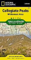
Collegiate Peaks Wilderness Area Map

National Geographic Maps
Collegiate Peaks Wilderness Area Map
National Geographic's Trails Illustrated Maps are the most detailed and up-to-date topographic recreation maps available for US National Parks, National Forests and other popular outdoor recreation areas. A necessity for exploring the outdoors, each map is printed on waterproof, tear-resistant material. They also contain key safety and contact information, GPS and compass coordinates, Leave No Trace ethical guidelines and hundreds of points-of...

Jasper North Map [Jasper National Park]

National Geographic Maps
Jasper North Map [Jasper National Park]
National Geographic's Trails Illustrated Maps are the most detailed and up-to-date topographic recreation maps available for US National Parks, National Forests and other popular outdoor recreation areas. A necessity for exploring the outdoors, each map is printed on waterproof, tear-resistant material. They also contain key safety and contact information, GPS and compass coordinates, Leave No Trace ethical guidelines and hundreds of points-of...

Banff North Map [Banff and Yoho National Parks]

National Geographic Maps
Banff North Map [Banff and Yoho National Parks]
National Geographic's Trails Illustrated Maps are the most detailed and up-to-date topographic recreation maps available for US National Parks, National Forests and other popular outdoor recreation areas. A necessity for exploring the outdoors, each map is printed on waterproof, tear-resistant material. They also contain key safety and contact information, GPS and compass coordinates, Leave No Trace ethical guidelines and hundreds of points-of...

Banff South Map [Banff and Kootenay National Parks]

National Geographic Maps
Banff South Map [Banff and Kootenay National Parks]
National Geographic's Trails Illustrated Maps are the most detailed and up-to-date topographic recreation maps available for US National Parks, National Forests and other popular outdoor recreation areas. A necessity for exploring the outdoors, each map is printed on waterproof, tear-resistant material. They also contain key safety and contact information, GPS and compass coordinates, Leave No Trace ethical guidelines and hundreds of points-of...

Botswana Map

National Geographic Maps
Botswana Map
AdventureMaps provide global travellers with the perfect combination of detail and perspective, highlighting hundreds of points of interest and the diverse and unique destinations within the country. Each map is printed on durable synthetic paper, making them waterproof and tear-resistant. They also include the locations of cities and towns with a user-friendly index, plus a clearly marked road network complete with distances and designations ...

Tanzania, Rwanda, and Burundi Map

National Geographic Maps
Tanzania, Rwanda, and Burundi Map
AdventureMaps provide global travellers with the perfect combination of detail and perspective, highlighting hundreds of points of interest and the diverse and unique destinations within the country. Each map is printed on durable synthetic paper, making them waterproof and tear-resistant. They also include the locations of cities and towns with a user-friendly index, plus a clearly marked road network complete with distances and designations ...

Israel Map

National Geographic Maps
Israel Map
AdventureMaps provide global travellers with the perfect combination of detail and perspective, highlighting hundreds of points of interest and the diverse and unique destinations within the country. Each map is printed on durable synthetic paper, making them waterproof and tear-resistant. They also include the locations of cities and towns with a user-friendly index, plus a clearly marked road network complete with distances and designations ...