
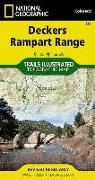
Coverage includes Pike National Forest, Roxborough State Park, Cheeseman Lake/Canyon, the gold medal trout waters of the South Platte River, cities of Westcreek, Deckers, Pine Nook, Sprucewood, Pine, Buffalo Creek and Waterton Canyon, Reynolds Park, Stoney Pass. Includes portions of the Colorado Trail. Includes UTM grids for use with your GPS unit.
Lieferbar
| ISBN | 9781566952798 |
|---|---|
| Sprache | eng |
| Cover | (Land)Karte |
| Verlag | Natl Geographic Maps |
| Jahr | 20190321 |
Dieser Artikel hat noch keine Bewertungen.